A digital addressing system that assigns a unique digital
postal code to every 8×8 meter square within Liberia’s borders.
LiberiaGPS is the a digital postal code system for Liberia, providing precise location data for every address across the country. Our mission is to enhance navigation, logistics, and service delivery by assigning unique GPS-based codes to every location, from Broad Street to remote rural communities.
{
            "liberia_gps_code": "MO-R1Q-82X",
            "county": "Montserrado",
            "region": "Bardnesville",
            "community": {
              "name": "MKK Community",
              "type": "Local Area"
  },
  "street_name": "New Georgia Estate Road"
}HOW LiberiaGPS Postal Codes WORK: Each digital postal code is designed to pinpoint a precise location using a structured format. The first two letters represent the county, followed by a combination of characters that identify the district or region, and a final segment that narrows it down to a specific community and street. This layered structure ensures accurate, easy-to-use location identification across the country.
| County Name | GPS Code | Example Code |
|---|---|---|
 Montserrado Montserrado | MO | MO-WEY-URH |
 Nimba Nimba | NI | NI-QE7-4JG |
 Grand Bassa Grand Bassa | GB | GB-K3D-8LM |
 Bong Bong | BG | BG-X9A-2RT |
 Lofa Lofa | LO | LO-K2M-7QP |
 Margibi Margibi | MG | MG-T5Q-9ZX |
 Grand Cape Mount Grand Cape Mount | CM | CM-P1Z-4BV |
 Gbarpolu Gbarpolu | GP | GP-R8L-6DN |
 River Cess River Cess | RC | RC-N3D-5KF |
 Sinoe Sinoe | SI | SI-W7B-2HJ |
 Grand Gedeh Grand Gedeh | GG | GG-Y6F-8PL |
 River Gee River Gee | RG | RG-U4H-3XM |
 Maryland Maryland | MD | MD-J2K-7QS |
 Grand Kru Grand Kru | GK | GK-V5E-1WA |
 Bomi Bomi | BM | BM-S9C-6RT |
Navigate every district, county, and address in Liberia with our live interactive map powered by precise GPS coordinates.
Open Map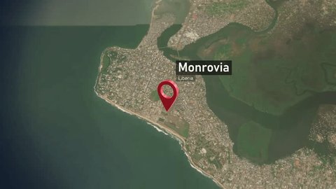
Have questions or need help? Our team is ready to assist you with anything related to LiberiaGPS.
gopawellc@gmail.com
Full API docs and integration guides available online.
Our project is open source and available on GitHub.